

Posts in category 'Great Oregon Hikes'
Subscribe and receive email notifications of new blog posts.
 RSS Feed
10
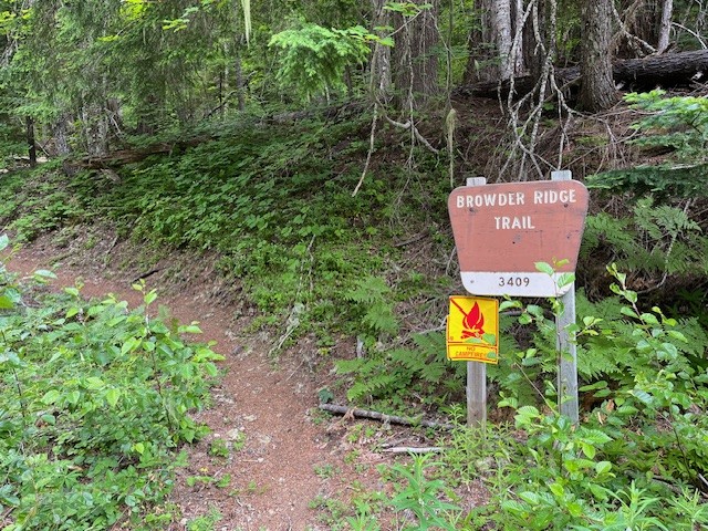
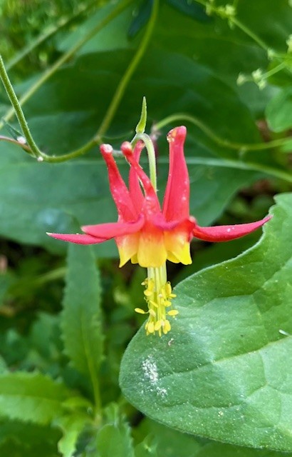
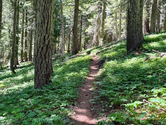
Browder Ridge Hike Is Blooming!
The Wildflowers and Views Are Fabulous at Browder Ridge
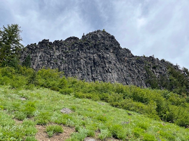
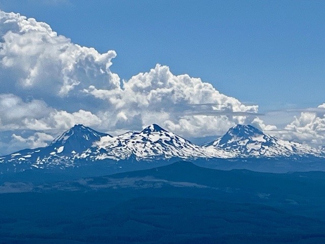
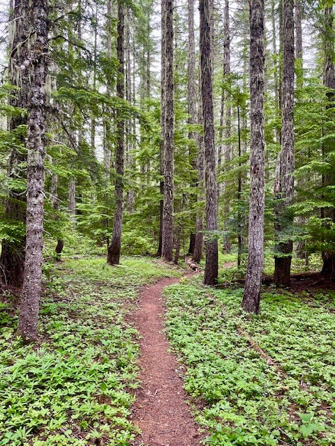
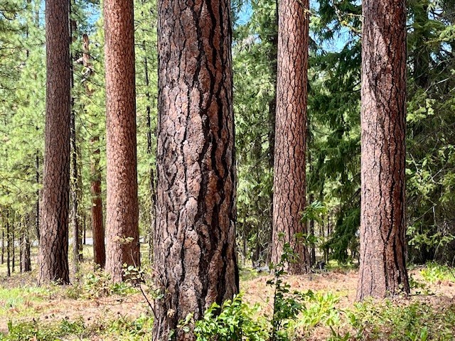
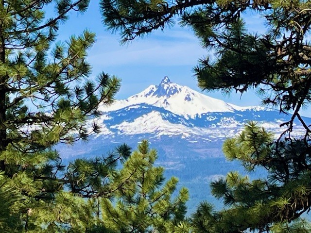
Iron Mountain remains one of the favored Central Oregon wildflower hikes that many people on both sides of the Cascades enjoy yearly. However, the lesser known and less traveled Browder Ridge offers even more wildflowers and views unseen from Iron Mountain. The easiest access to Browder Ridge Trail is near the Iron Mountain trailhead a few miles up paved forest service road 15.
In early July 2025, the wildflowers were blooming and the air was clear, providing outstanding views of multiple peaks of the Cascades. The hike from the trailhead off forest service road 15 climbs over 2300 feet to the peak at the top of Browder Ridge at a distance slightly more than six miles one direction. Varied shade loving and sun loving wildflowers can be seen throughout the hike.
 |
 |
 |
 |
 |
 |
30
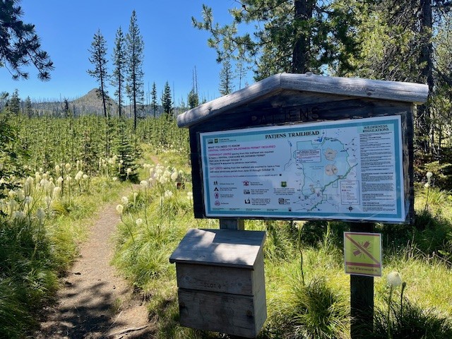
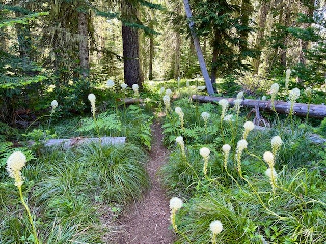
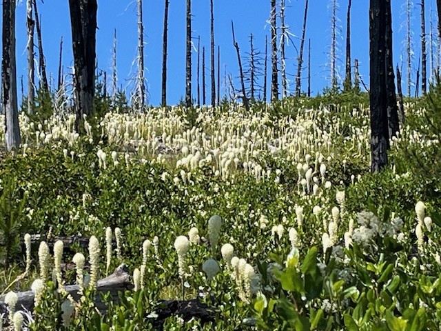
The Bear Grass is Blooming at Patjens Lakes Loop Trail
Patjens Lakes Loop Trail is a Moderate Hike in the Mt. Washington Wilderness
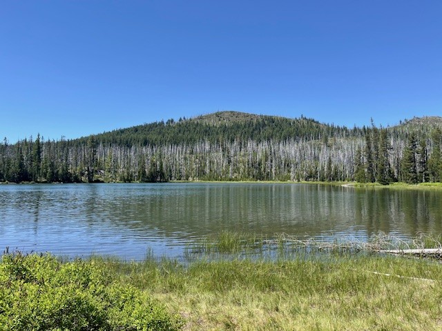
For those who are looking for a Bear grass hike in Central Oregon, Patjens Lakes Loop Trail is hard to beat the end of June 2025. When hikers leave Hwy 20 to drive to the paved trailhead near the end of Big Lake Road, blooming Bear grass can be seen on each side of the road, a great indicator that the hike has a significant amount of it seen during the trek. Patjens Lakes Loop Trail runs adjacent to Big Lake at Santiam Pass before it leaves the lake to run south into the Mt. Washington Wilderness where it skirts the 4 small Patjens Lakes before returning to the starting point next to Big Lake. There are still signs of the B & B complex fire of 2003 which burned over 90,000 acres in the Mt Washington and Mt Jefferson Wildernesses, running along the crest of the Cascades. However devastating the fire was to the area, the burned areas provided more growing areas to sun-loving plants, such as Bear grass.
 |
 |
 |
 |
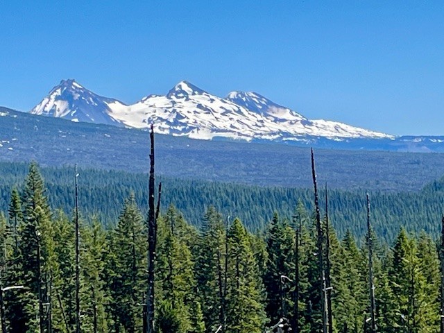
Areas untouched by the fire retain the lush undergrowth and tall trees of most Western Oregon old growth forests, complete with shade-loving plants and many birds. The last two miles of the hike, however, are in the burned area. Part of the path climbs a ridge from which hikers have amazing views of the Three Sisters, Black Crater, Hoodoo Ski Area, Three Fingered Jack and Mt. Washington. The slope of this ridge is covered with Bear grass and the Cascade views would not be evident had the area remained unburned.
The entire hike is under 7 miles with a little over 700 feet of elevation gain, considered by many a moderate route.
 |
 |
23
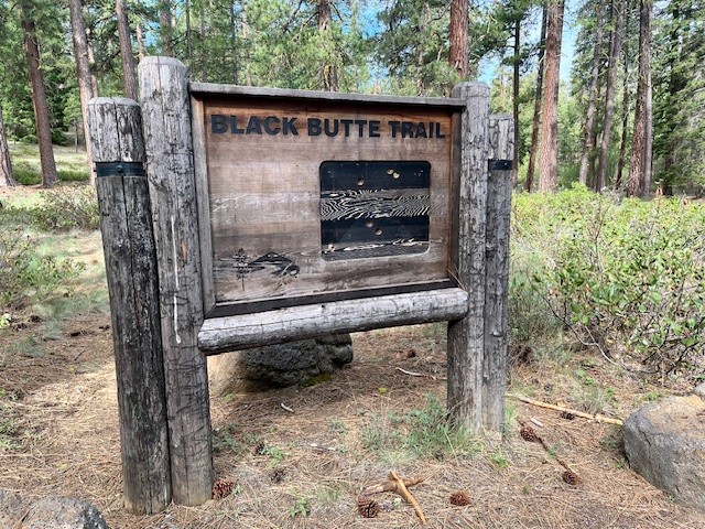
The Historic Black Butte Hike Can Be Challenging
There Are Two Trailheads to Summit Black Butte
Many people will hike to the summit of Black Butte during the summer. It is an iconic volcano located just outside of Sisters next to Black Butte Resort which challenges both visitors and locals. Most people will take the gravel road which transitions into a terrible dirt road to the upper trailhead which is located 1500 feet below the summit. Hikers who start here will find a limited space parking area complete with facilities which require a current forest pass. Those who really want to challenge themselves can start at the base of Black Butte at the historic trail head located near Camp Sherman. The road to this trailhead is mostly paved until the turn off to the parking area so hikers avoid driving over challenging dirt roads before they start their trek. No parking pass but very limited parking available.
 |
 |
For those hiking the historic route, the trail gradually climbs as hikers pass through the old growth forest located at the base of Black Butte. In May, 2025, early signs of spring were evident with blooming wildflowers. After roughly 3/4 of a mile, the path steepens and hikers start climbing Black Butte. Peek-a-boo views of Black Butte Ranch, Suttle Lake, and the Cascades can be seen through the tall Ponderosa Pines.
 |
 |
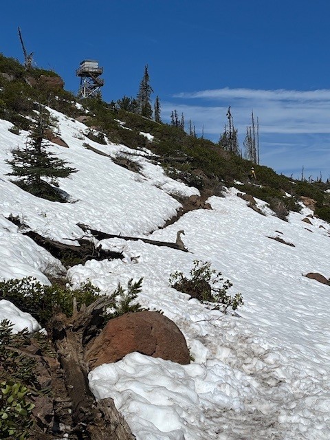
After 3 miles the Historic Black Butte Trail reaches the upper trailhead and the last two mile of the hike is along this route. At the top of Black Butte in the middle of May, 2025, snow patches remained which were easily crossed. The top of the Butte was relatively snow free with all structures still locked and inaccessible to early visitors.
 |
 |
Hikers can enjoy the top of Black Butte with amazing Cascade Views. On a clear day, as many as 13 peaks can be seen from Mt. Bachelor in the south all the way to Mt. Adams in Washington to the north. After spending time at the summit, hikers need to descend back to the trail head in Camp Sherman. All in all, the historic Black Butte Trail is over 10 miles with 3400 feet of elevation gain in the ascending 5 miles.
 |
 |
22
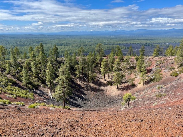
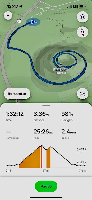
Lava Butte is a Quick Hike Near Bend
Lava Butte is Located Just South of Bend
Lava Butte is part of the Lava Lands Visitor Center which is the interpretive hub for Newberry Volcanic National Monument. Located just south of Bend on the west side of Highway 97, the Visitor Center is closed from the middle of October through the beginning of May. However, the parking lot remains open year round (snow permitting) for people who hike the 5.5 mile Sun-Lava paved path over the lava fields or hike the 3.3 mile round trip up Lava Butte. The road up Lava Butte is traveled by a shuttle during the summer, but during the off season a gated fence stops vehicles from making the trip. However, hikers and bicyclists can access the butte through a person gate in the fence and enjoy the trek up the butte and views from the top.
 |
 |
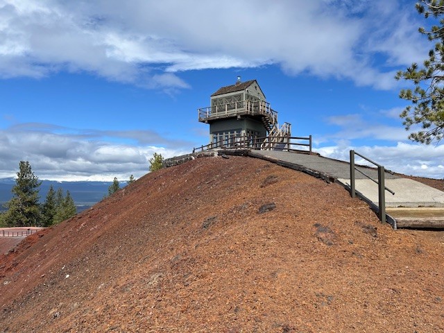
Those who walk the 1/4 mile around Lava Butte's rim can read a lot about the geology of the area in the interpretive signs. Newberry Crater is the largest volcano in the Cascade Volcanic Arc, with an area of 1,200 square miles when its lava flows are taken into account; this area is larger than the state of Delaware. From north to south, the volcano has a length of 75 miles, with a width of 27 miles and a total volume of approximately 120 cubic miles. Over 400 lava buttes are part of the volcano, Lava Butte being one of them. From the top of the butte, many other cinder cones are visible, among the most popular for Bend residents is Pilot Butte located within the city limits.
Although not a long hike, the trek up Lava Butte provides for almost 600 feet in elevation gain along a paved road. For those who want more, there are many additional hikes in Newberry Volcanic National Monument which become available late spring/early summer.
 |
 |
9
Alder Springs is a Central Oregon High Desert Hike Outside of Sisters
Alder Springs Flows Into Wychus Creek
The hike to Alder Springs outside of Sisters limits motorized access from December 1st through March 31st to protect the winter rangeland of the local deer populations. However, access to the trail head is on rough dirt roads for which 4 wheel drive and high vehicle clearance is recommended. Directions to the official trail head can be found on the USDA website. The "unofficial" route involves travel on Locust Street (Camp Polk Road) in Sisters 3.1 miles north from East Cascade Avenue. Take this to Wilt Road, staying on Wilt when the pavement ends 4 miles. Past Rimrock Ranch the road is less maintained. Travel another 2.2 miles until you see a sharp unmarked turnoff to the right onto a rough dirt road. The weekend of April 5, 2025 this road was almost impassible with deep rutted mud which required challenging driving to get through. Travel on this past a gate until you reach a picnic area next to Whychus Creek which provides for a water crossing during dry times of the year. There is a beautiful mesa above the crossing and signage for a Native American archaeological site.
 The early stages of the hike involves traveling next to the creek for a mile, the narrow path following the slope and involving short stretches of climbing followed by level areas. After a mile, the path steepens and hikers travel up the canyon slope and traverse above the river, with several areas close to the steep canyon cliff. Hikers should be careful here. In addition, the open high desert landscape with scattered juniper trees, sagebrush and fescue grass has limited shelter and sun exposure can be an issue with on warm summer days.
After 4.5 miles, the path drops into the bend of Wychus Creek which also contains Alder Springs. The traditional hike following the Ochoco National Forest website to Alder Springs meets here. Those who hike the recognized path have to wade across Wychus Creek here. In April 2025, the creek was full with the heavy winter snows just starting to melt.
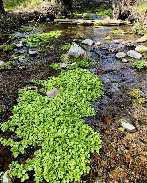
Alder Springs itself is a beautiful oasis of water bubbling up from the ground flowing into Wychus Creek, surrounded by deciduous trees and dogwood, with Seep Monkeyflower growing in bunches on limited higher ground in the springs.
 |
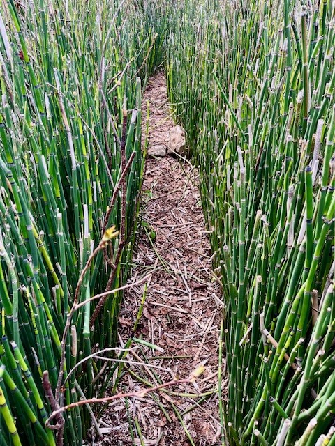 |
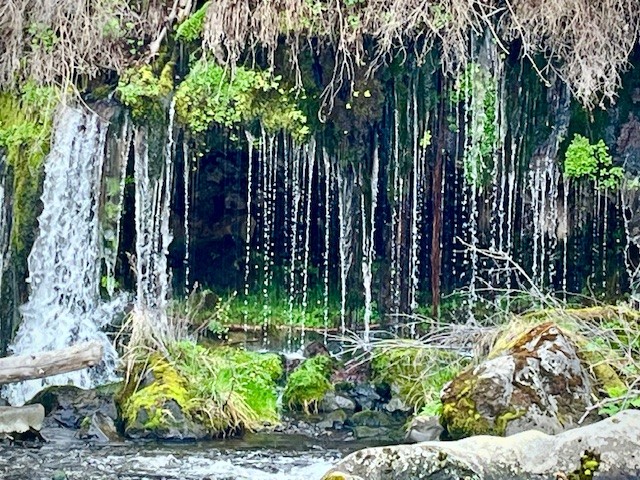
For those who wish to hike the mile and a half to the confluence of Whychus Creek with the Deschutes River, the trail has much heavier vegetation. With few people hiking this area, there are sections of the trail overgrown and hikers have to look out for both rocks which can trip people and branches which can hit heads and bodies. Part of the trail goes through a grove of horsetail. Just before reaching the confluence, there is a beautiful weeping wall with a spring of water flowing into Whychus Creek, resembling a waterfall. Hikers have to know to look for this as access to the view has heavy vegetation and it is difficult to maneuver through this.
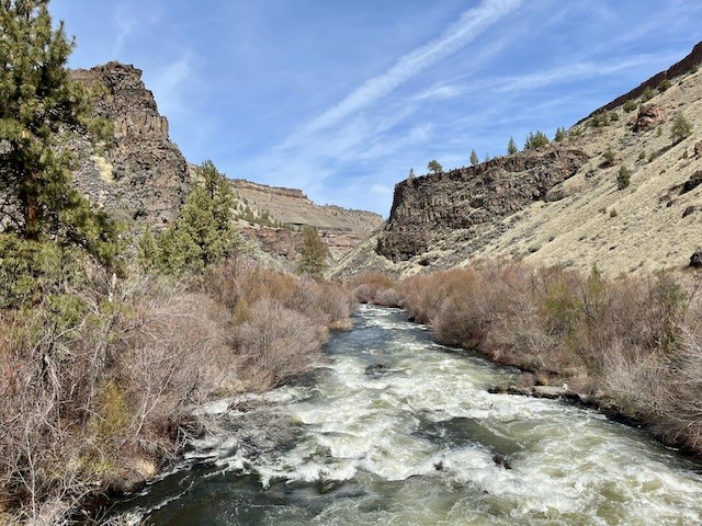
At the confluence, beautiful rock canyon walls and a welcoming rock overlooking both rivers make for a great lunch spot. In April 2025 the water levels were very high, higher than seen in earlier years. All in all, the full hike is over 11 miles with just over 1000 feet of gradual elevation gain.
 |
 |
Privacy Policy / DMCA Notice / ADA Accessibility