

Posts with tag 'Hiking Central Oregon'
Subscribe and receive email notifications of new blog posts.
 RSS Feed
10
Bend Premier Real Estate | January 2025 Newsletter
What's in the January 2025 Bend Premier Newsletter?
- More Inventory and Moderate Price Increase the Norm in 2024
- Creamy Mushroom Pasta
- Cozy Ideas to Transform Your Living Room This Winter
- Hike Smith Rock for a Winter Challenge
- Get Ready to Sell a Home in 2025
8
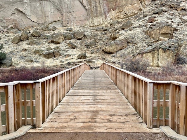
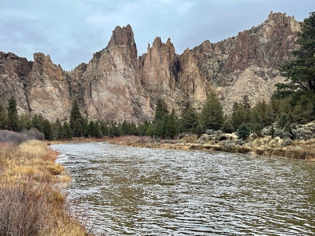
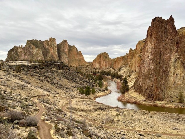
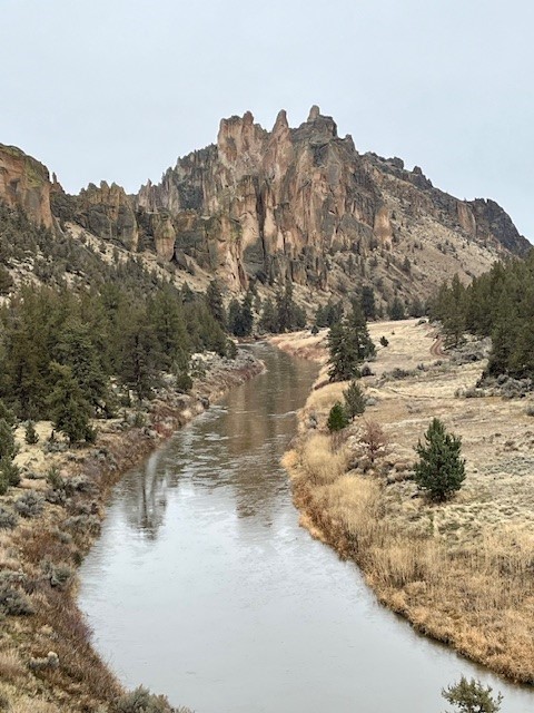
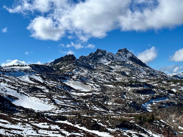
Hike Smith Rock's Burma Road and Misery Ridge Loop for a Great Winter Experience
The Burma Road, Summit Trail, Misery Ridge Loop Can be Challenging
For those looking to undergo a challenging Central Oregon hike when the Cascades are covered with snow, Smith Rock State Park can provide many options. Typically very busy in the summer when rock climbing is at its peak and the weather warm, winter hikes in Smith Rock can be rewarding with fewer crowds and different perspectives of the rocks. Before sections of the park are shut off in the spring due to falcon nesting, hikers can explore little known social trails and see portions of the park rarely visited. However, for those who wish to exert themselves, hiking along the Wolf Creek trail until connecting with Burma Road, climbing it and then hiking the north side of the park along the Summit Trail, then up Mesa Verde until connecting with Misery Ridge and climbing the backside past Monkey Face to the summit until returning down to Crooked River and then up the canyon to the parking lot can be a fulfilling winter hike of over six miles and close to 1800 feet of elevation gain. During the winter, sometimes weather conditions can create icy patches, so microspikes and trekking poles can be helpful. But if the weather cooperates, the Burma Road, Misery Ridge Loop can be a wonderful challenge.
 |
 |
 |
 |
6
Bend Premier Real Estate | December 2024 Newsletter
What's in the December 2024 Bend Premier Newsletter?
- More Inventory Means More Choices for Bend Homebuyers
- Eggnog Pie
- The Dos and Don'ts for Holiday Decorating When Selling
- Hike to Paulina Falls in Winter for a Truly Unique Experience
- Ready to Sell in 2025
7
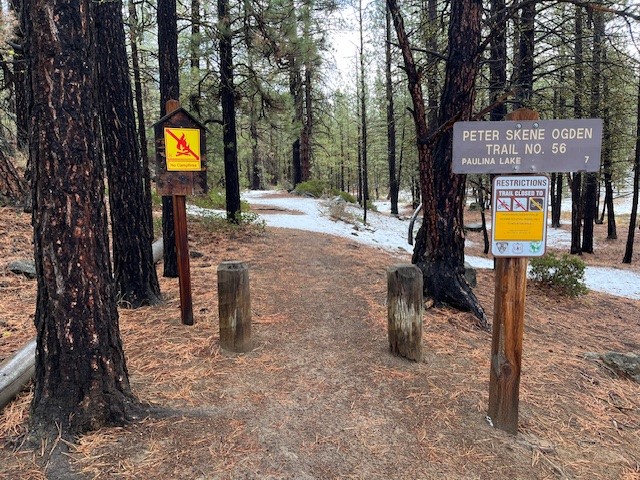
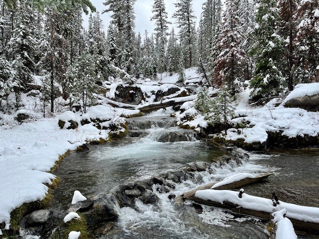
Hike to Paulina Falls in Winter for a Truly Unique Experience
Hike to Paulina Falls in the Winter for a Unique Experience
Once the roads into the high Cascades have been closed for the winter, there are more limited hiking opportunities for Central Oregonians. However, one favorite hike is close to La Pine state park and on the road to Newberry Crater. This is the Peter Skene Ogden trail which follows Paulina Creek all the way to Paulina Lake. Hikers can take the trail as far as they wish, although during winters with heavy snow, it can be challenging and snow shoes would be recommended.
November 2, 2024 was scheduled to be cloudy, but dry. The lower elevations of Peter Skene Ogden Trail had patchy snow, but it was easy walking.
 |
|
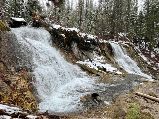
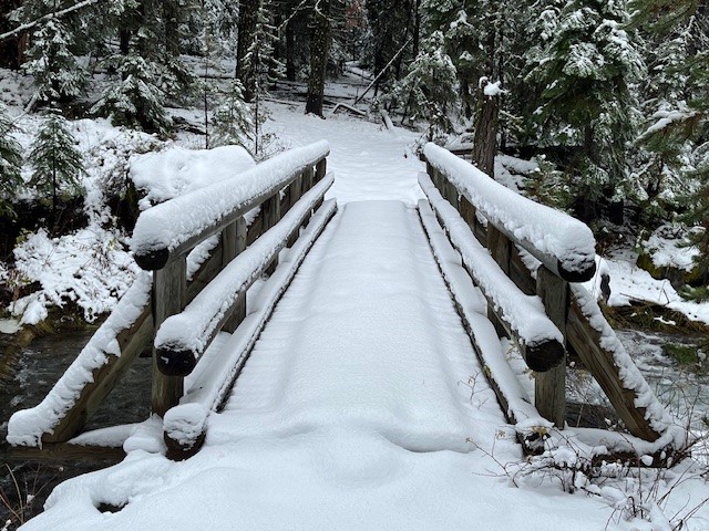
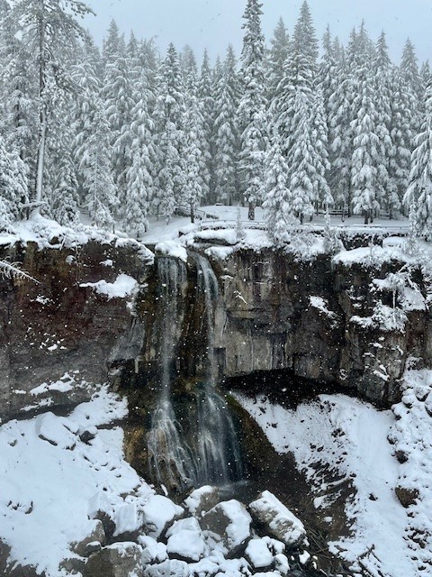
Two and a quarter miles into the hike, the second large, "twin" waterfall is passed and then the hike steepens until the bridge is reached which crosses over Paulina Creek. Past the bridge the snow deepened and hikers without snowshoes had to post hole in soft snow to get any further.
 |
 |
The path also steepens past the bridge and there was more accumulated snow. Central Oregon typically doesn't get a lot of snow early November, but 2024 was different with the snow depth on Peter Skene Ogden Trail over a foot at Paulina Falls. With more snow falling and the trees covered in a snow blanket, it was truly a winter wonderland with no other hikers seen. The entire hike up and back was just under twelve miles and over 1500 feet of elevation gain.
 |
30
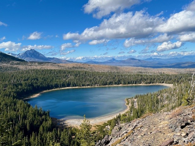
Hiking Tam McArthur Rim to No Name Lake in Fall is an Experience
Cascade Mountain Hikes in Fall Can Have Unexpected Weather Conditions
Hiking in the Oregon Cascades in the fall can offer amazing experiences with stunning views, early snow, fall colors, and no need for forest passes. However, the weather can also change suddenly and hikers need to be prepared.
On October 26, 2024, the hike from Three Creeks Lake to Tam McArthur Rim began with low clouds covering the Cascades. The hike up from the trailhead (the sign was already covered for winter), to the rim experienced some wind, although much of the early part of the trail was in sheltered forest. Once reaching the rim, the winds really picked up, but the clouds also lifted so that the mountains (Broken Top, The Three Sisters, Mt Washington, Three Fingered Jack) could be seen.
 |
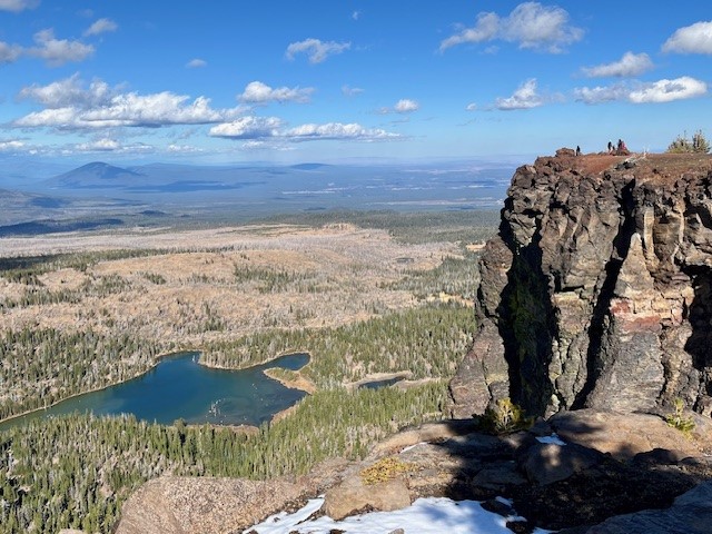 |
Typically the unmaintained trail from Tam McArthur Rim to Broken Top and No Name Lake is fairly simple until hikers reach the cinder rim which is traversed before getting to Broken Hand. On October 26, the clouds lifted and the wind picked up. For those not prepared for wind chill, the gusty winds would have really impacted comfort. Hiking below Broken Hand rather than across the face made a lot of sense as the wind was getting even more fierce. Upon reaching the ridge overlooking No Name Lake, the wind was extremely strong and it was difficult to even stand; anything loose would have been blown off the ridge. Getting a few pictures and returning to a more sheltered space behind a rock outcropping made sense, as well as drinking hot drinks before attempting the trek back. Very few people traveled this hike to Broken Top this day, although upon returning to Tam McArthur Rim, there were a good number who had reached the rim in the afternoon once the weather warmed a bit.
Anyone who hikes in the Cascades in the fall needs to be prepared for changing weather and unexpected situations. But for those who do, the rewards can be amazing.
 |
 |
Privacy Policy / DMCA Notice / ADA Accessibility