

Posts with tag 'Sisters'
Subscribe and receive email notifications of new blog posts.
 RSS Feed
30
Hiking Tam McArthur Rim to No Name Lake in Fall is an Experience
Cascade Mountain Hikes in Fall Can Have Unexpected Weather Conditions
Hiking in the Oregon Cascades in the fall can offer amazing experiences with stunning views, early snow, fall colors, and no need for forest passes. However, the weather can also change suddenly and hikers need to be prepared.
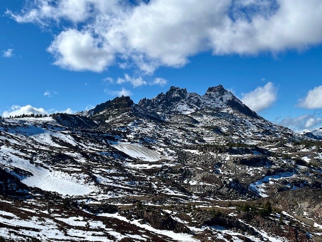
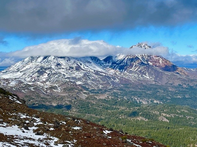
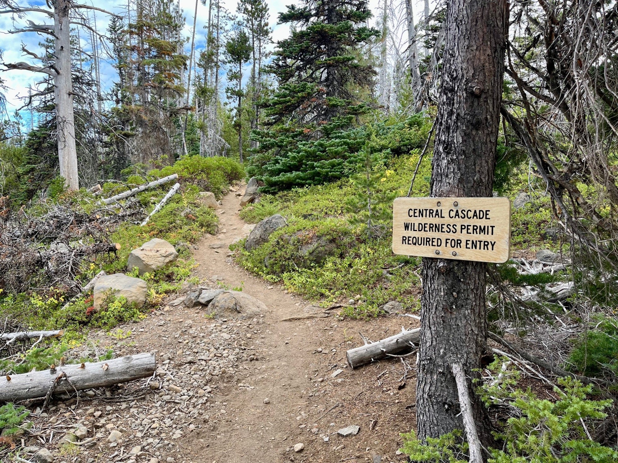
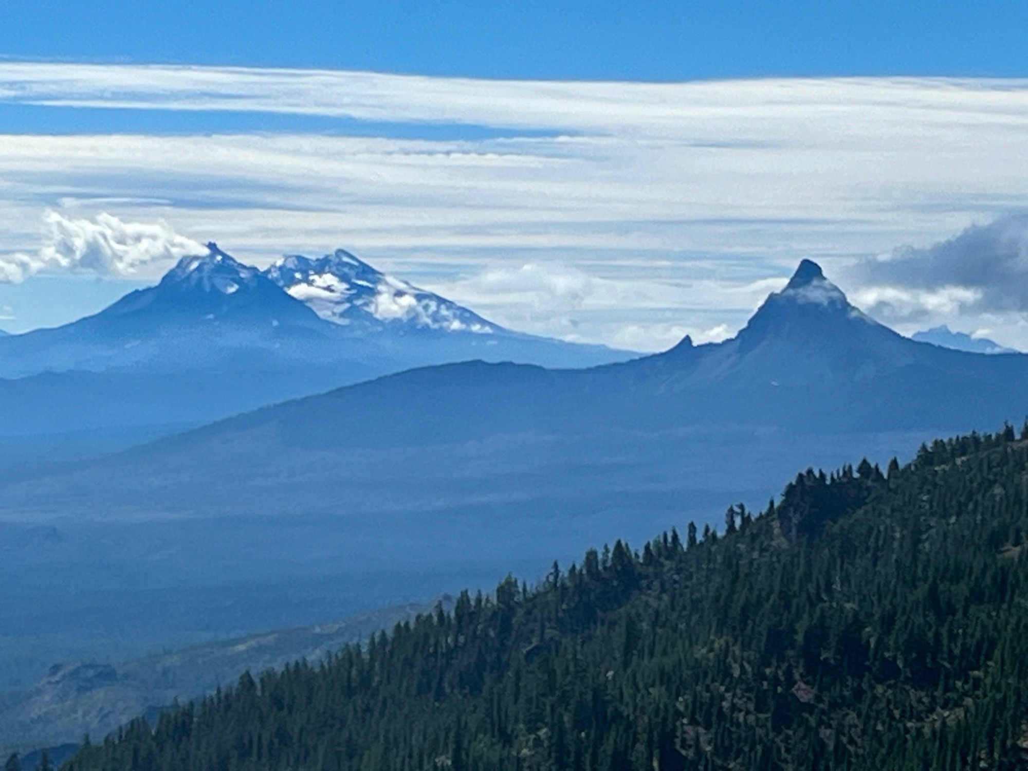
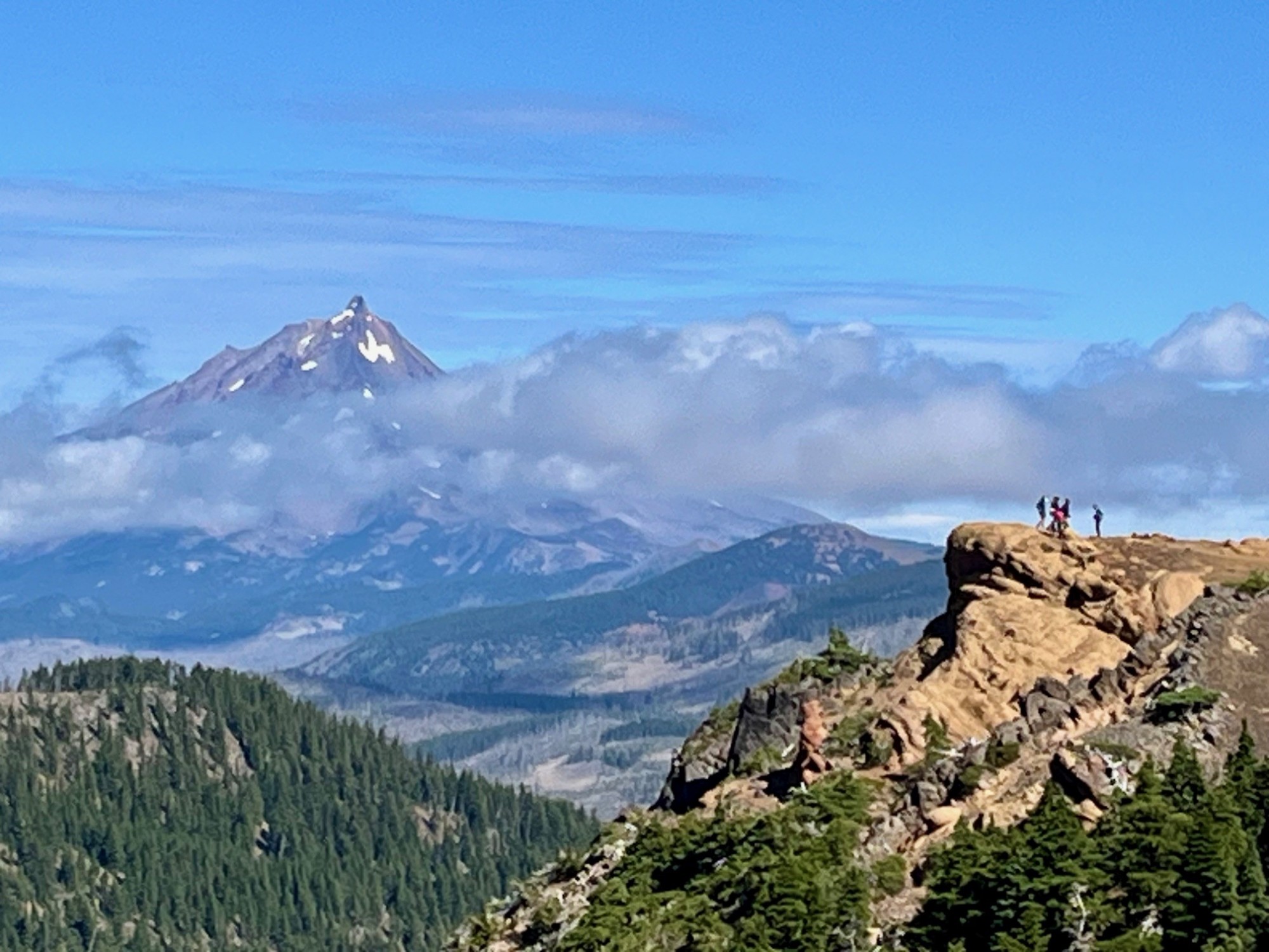
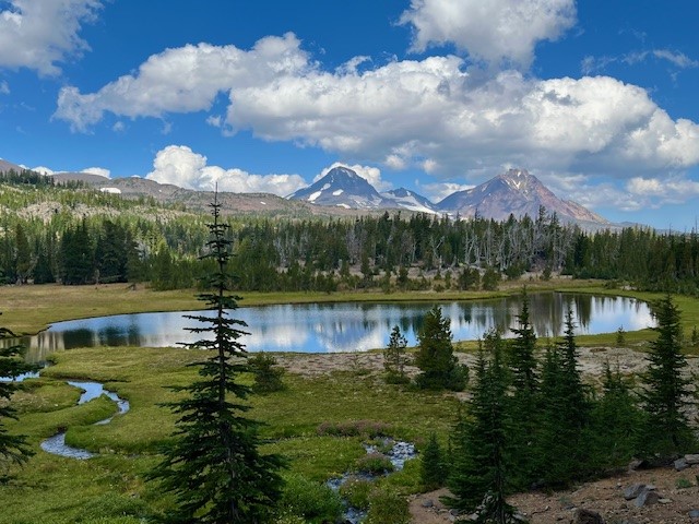
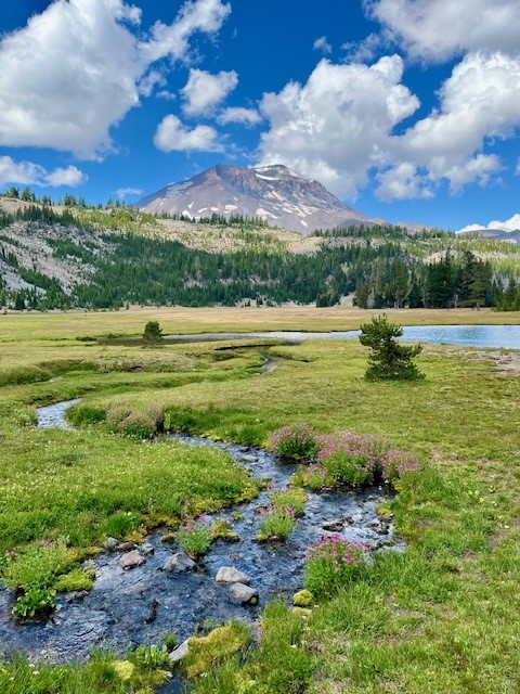
On October 26, 2024, the hike from Three Creeks Lake to Tam McArthur Rim began with low clouds covering the Cascades. The hike up from the trailhead (the sign was already covered for winter), to the rim experienced some wind, although much of the early part of the trail was in sheltered forest. Once reaching the rim, the winds really picked up, but the clouds also lifted so that the mountains (Broken Top, The Three Sisters, Mt Washington, Three Fingered Jack) could be seen.
 |
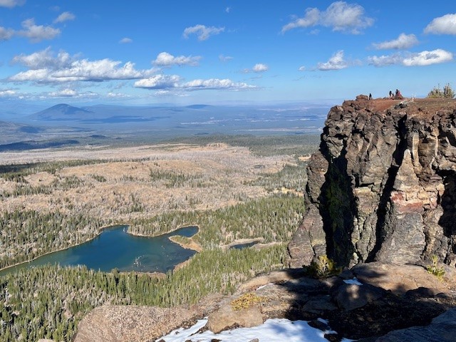 |
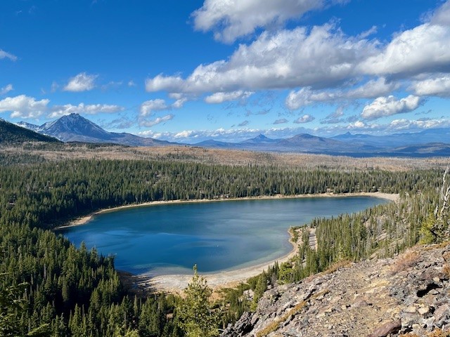
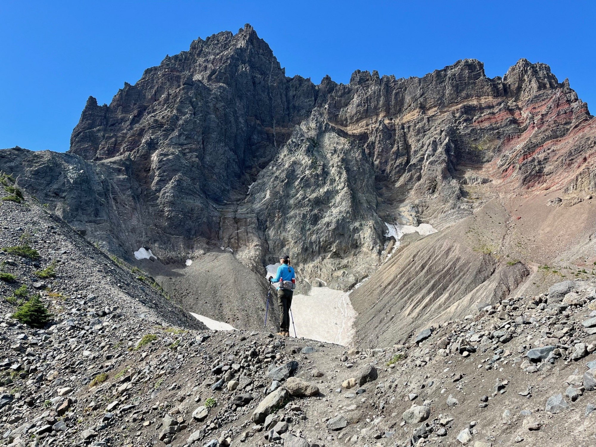
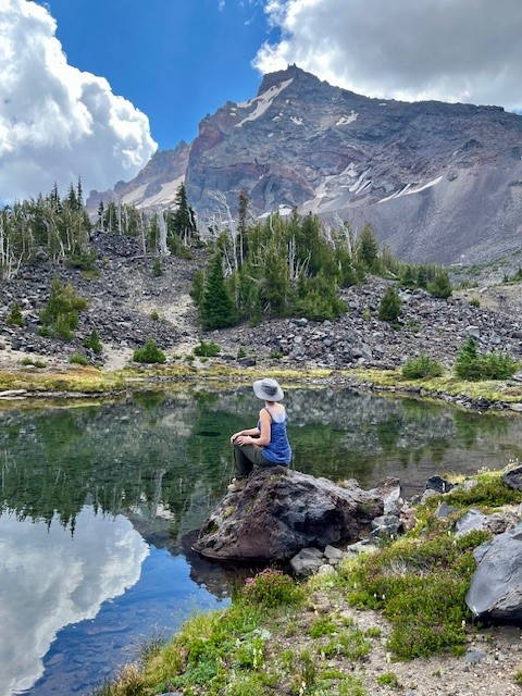
Typically the unmaintained trail from Tam McArthur Rim to Broken Top and No Name Lake is fairly simple until hikers reach the cinder rim which is traversed before getting to Broken Hand. On October 26, the clouds lifted and the wind picked up. For those not prepared for wind chill, the gusty winds would have really impacted comfort. Hiking below Broken Hand rather than across the face made a lot of sense as the wind was getting even more fierce. Upon reaching the ridge overlooking No Name Lake, the wind was extremely strong and it was difficult to even stand; anything loose would have been blown off the ridge. Getting a few pictures and returning to a more sheltered space behind a rock outcropping made sense, as well as drinking hot drinks before attempting the trek back. Very few people traveled this hike to Broken Top this day, although upon returning to Tam McArthur Rim, there were a good number who had reached the rim in the afternoon once the weather warmed a bit.
Anyone who hikes in the Cascades in the fall needs to be prepared for changing weather and unexpected situations. But for those who do, the rewards can be amazing.
 |
 |
11
Central Oregon Real Estate Market Trends - Third Quarter 2024
Is Central Oregon Real Estate Moving to a Balanced Market?
In Q3 2024, the Bend Oregon Real Estate market and surrounding communities experienced a change, moving closer to a balanced market after many years of being a seller's market. The number of listings grew, days on market increased, but prices appear to have leveled off, at least within Bend and Redmond. In Bend, Redmond, Powell Butte and Black Butte Ranch, the number of sold homes increased as third quarter 2024 also saw mortgage interest rates drop. Outside of Redmond and Sunriver, all of the Central Oregon real estate markets saw an increase in new listings year over year, many above 20%. This can partly be attributed to sellers recognizing that with lower mortgage interest rates, the cost of their replacement property would be less and the delayed move they planned on taking could finally happen.
4
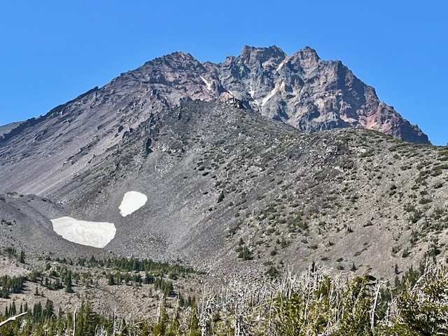
Canyon Meadow Hike is a Great Way to Explore Three Fingered Jack
Canyon Meadow is a Permitted Hike in the Mt Jefferson Wilderness
Canyon Meadow is a relatively easy hike in Central Oregon if limited to just the meadow loop which takes trekkers through burned forest, old growth forest and the meadow back to the beginning at Jack Lake. However, many will take the one way climb past the meadow up to the base of Three Fingered Jack. This adds significant elevation gain as well as beautiful views of Three Fingered Jack, sometimes including mountain goats and technical climbers on the craggy top of the mountain. For those adventurous enough to climb the loose rock and pumice past the glacial lake onto the ridge separating Three Fingered Jack from the nearby unnamed hill, the views south toward the Three Sisters and Mt. Washington and the views north toward Mt. Jefferson are spectacular.
 |
 |
 |
 |
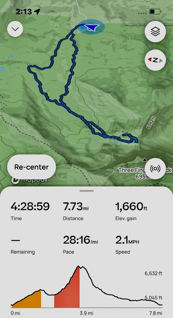
Scrambling down the loose scree from the view points takes time, and trekking poles can be very helpful. Once the difficult section of the hike is passed, people can return the way they had come, or for a difference experience they can hike down the meadow following the stream that flows from the moraine holding the glacial lake. During certain times of the year, this path can be through acres of lupine dominated wildflowers. For those who take the entire Canyon Meadow loop as suggested, the trip results in over 1600 feet of elevation gain and under eight miles in length.
 |
 |
4
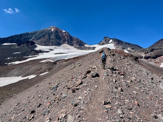
Take the Climbers Trail to Middle Sister and See Sights Few Experience
If you are one of the people who love to climb mountains, you are probably familiar with the climber's trail which provides the established way to summit North Sister in the Oregon Cascades. For those not that ambitious but who love a long day hike, taking the trail part way will enable hikers to have amazing Cascades views plus close up access to Hayden Glacier on Middle Sister.
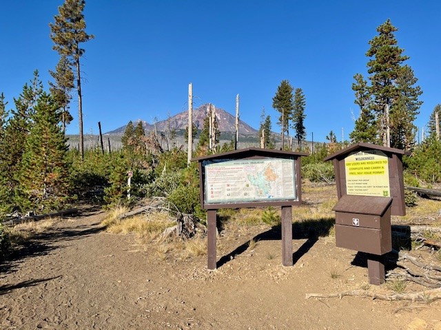
The route to Hayden Glacier starts at the Pole Creek Trailhead. This is the same trail that is taken to reach Camp Lake which provides for wonderful access to the north facing slopes of South Sister. The first 3.5 miles is through the burned forest of the 2012 Pole Creek fire, but after leaving burned woods, the trail enters healthy forest and the trek is shaded. Before hikers reach the North Fork of Whychus Creek, an unmarked trail intersects the main path. Climbers take this path (which has an optional loop up and back) to access the hike to summit North Sister.
 |
 |
The climbers' trail gains elevation quickly as hikers walk up the lower slopes of Middle and North Sister. The first mile or so remains in shaded forest, but as hikers gain elevation, they leave forest and start walking through the jumbled rock and ash of multiple moraines. At one time these were filled with glaciers, but these have mostly melted, leaving behind the steep gullies and loose stone scrapped off the mountains over thousands of years. Climbing up the moraines can be difficult, but coming down is harder as it is easy to slip on the loose stone.
 |
 |
For those who do continue the technical climb up North Sister, it is recommended this be done in a group with people who really know what they are doing. For those of us who just enjoy a great, long day hike, the option to travel to Hayden Glacier is one very few do and it can be very rewarding. The entire trip, including the loop up and back the climber's trail, is under 3000 feet of elevation gain and less than 13 miles back to the Pole Creek Trailhead.
21
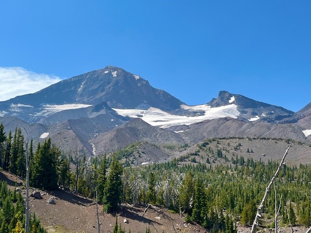
Golden Lake is a Hidden Treasure in the Three Sisters Wilderness
Golden Lake is Not an Easy Hike
For Central Oregon residents and visitors looking for a great day hike, there are a good number of options available. For many, a hike of 2 to 4 miles to an amazing destination followed by the same distance back can create a full day with time to relax and enjoy both the original destination and the time back home. However, for those wishing to see more in the Cascade forests besides what is seen in a day hike, many will backpack and spend more time enjoying the destination before venturing further or coming back.
Golden Lake is one of those rarely seen destinations. It can be accessed through multiple approaches. These include the popular Green Lakes Trail in which hikers walk past the northern most Green Lake and travel above the valley to the pass between South Sister and Broken Top and then down the path that leads to Park Meadow, making sure they take the unmarked trail off this path and hike the half mile to Golden Lake. Another approach is from Three Creeks Lake, taking the Park Meadow trail and hiking through and past Park Meadow towards Green Lakes and then taking the unmarked trail to Golden Lake. Both approaches are over seven miles one direction, but the approach from Three Creeks Lake is a little shorter.
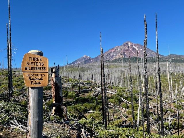
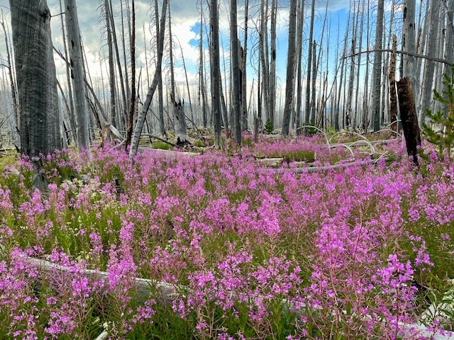
Hikers coming from Three Creeks Lake are required to walk through four miles of burned forest, the result of the Milli Fire seven years ago. There is beauty, however, in the recovering forest with many wildflowers and young trees growing back. Past the burned area, hikers enter forest before they reach Park Meadow, which was untouched by fire and a place many backpackers will spend the night. The trail steepens past park Meadow and after another mile and a half, the turn off to Golden Lake is reached.
 |
 |
The name for Golden Lake is obvious during certain times of the year when yellow wildflowers are blooming in the meadow that surrounds the lake. The lake itself can reflect Broken Top, South, Middle and North Sisters on calm days. The setting is serene and lovely with very few people around.
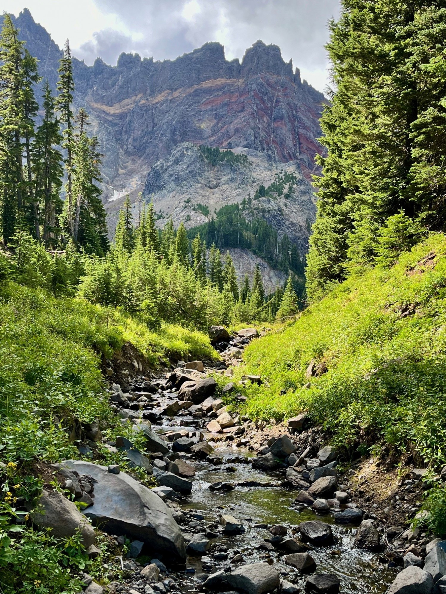
However, one of the most special things about Golden Lake is the small stream which flows into the western side of the lake. Besides the numerous wildflowers growing on each side of the stream, people who take the time to hike the mile up that stream reach an isolated area that very few people ever visit. That last mile is steep, but the cascading stream with its wildflowers and ever changing views of the Three Sisters are amazing. At the end of the stream is a moraine which contains two springs which form the stream. People who scramble up the moraine will reach an isolated tarn lake and past that, another moraine and a second tarn lake even more special than the first. This second lake has phenomenal reflections and views of Broken Top. For those who are able to travel the entire distance, the reward can be some of the most breathtaking natural sights in Central Oregon. It is truly an exceptional place.
For those having enough energy to do the entire hike in a day starting from and returning to Three Creeks Lake, plan on sixteen miles (eight in the burned forest) and over 2000 feet of elevation gain.
 |
 |
Privacy Policy / DMCA Notice / ADA Accessibility